Previous | Main | Next |
West Thumb Geyser Basin
Yellowstone Lake is the largest freshwater lake above 7,000 ft (2,100 m) in North America.[1]
In winter, ice nearly 3 ft (0.91 m) thick covers much of the lake except where shallow water covers hot springs. The lake freezes over by early December and can remain frozen until late May or early June.
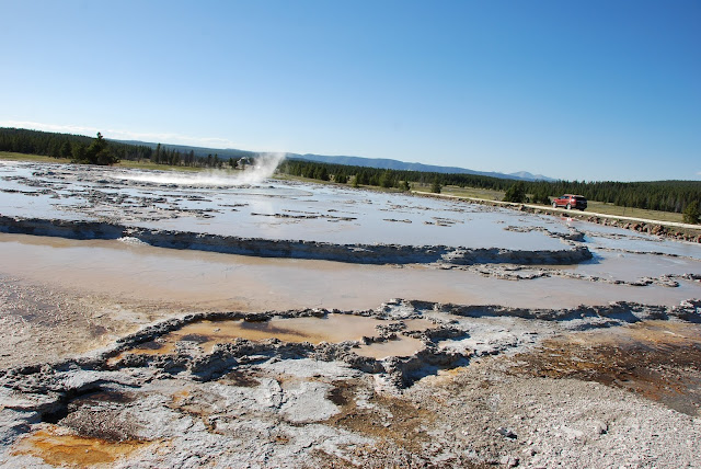
The West Thumb Geyser Basin, including Potts Basin to the north, is unique in that it is the largest geyser basin on the shores of Yellowstone Lake. The heat source of the thermal features in this location is thought to be relatively close to the surface, only 10,000 feet down! The West Thumb of Yellowstone Lake was formed by a large volcanic explosion that occurred approximately 150,000 years ago (125,000-200,000). The resulting collapsed volcano, called a caldera ("boiling pot" or caldron), later filled with water forming an extension of Yellowstone Lake. The West Thumb is about the same size as another famous volcanic caldera, Crater Lake in Oregon, but much smaller than the great Yellowstone caldera which formed 600,000 years ago. It is interesting to note that West Thumb is a caldera within a caldera.
 |
| Yellowstone Lake |
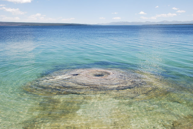 |
| Geyser cone under water (Fishing cone) |
 |
| Black Pool |
 |
| Abyss Pool |
Upper Geyser Basin
The Upper Geyser Basin is famous for hosting Old Faithful Geyser. But there is much more in the area than just this famous geyser. The Upper Geyser Basin also boasts the largest concentration of geysers in the world, including many of the worlds largest geysers.
Five of the largest geysers are predicted by the Park Rangers. All of these geysers, Castle, Daisy, Grand, Old Faithful and Riverside, are worth seeing but if you can only see one, try to see Grand.
 |
| Doublet Pool |
 |
| Castle Geyser |
The Old Faithful Inn is a hotel located in Yellowstone National Park, Wyoming, United States, with a view of the Old Faithful Geyser. The Inn has a multi-story log lobby, flanked by long frame wings containing guest rooms.
With its log and limb lobby and massive (500-ton, 85-foot) stone fireplace, the inn is an example of the "Golden Age" of rustic resort architecture, a style which is also known as National Park Service Rustic. It is rare in that it is one of the few log hotels still standing in the United States, and was the first of the great park lodges of the American west.
 |
| The Old Faithful Inn |
 |
| Old Faithful |
 |
| Old Faithful |
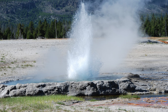 |
| Crested Pool |
 |
| Firehole River |
 |
| Morning Glory Pool |
Midway Geyser Basin
Midway Geyser Basin contains a small collection of mammoth-sized springs. Midway is part of the Lower Geyser Basin, but because of its isolated location between the main features of Lower and Upper geyser basins it became known as Midway. Rudyard Kipling, who visited Yellowstone in 1889, immortalized this basin by referring to it as "Hell's Half Acre." Even today it is still remembered by that name. Despite its small size Midway possesses two of the largest hot springs in the world. Grand Prismatic Spring, nearly 370 feet in diameter, sits upon a large mound surrounded by small step-like terraces. The other feature, Excelsior Geyser, erupted nearly 300 feet high before the 1900s. It is now a dormant geyser and is considered a hot spring, discharging more than 4050 gallons of boiling water per minute. Other colorful springs include Turquoise and Indigo springs, known for their pale and dark blue colors. Across the Firehole River from Excelsior and Grand Prismatic springs are a series of small isolated, pristine springs and mud pots. The Rabbit Creek drainage possesses some colorful and unusual features and most are unnamed. Caution should be exercised while exploring this vicinity since the ground is unstable and trails are not maintained.
Map
 |
| Microbial mat |
The vivid colors in the spring are the result of microbial mats around the edges of the mineral-rich water. The mats produce colors ranging from green to red; the amount of color in the microbial mats depends on the ratio of chlorophyll to carotenoids and on the temperature gradient in the runoff. In the summer, the mats tend to be orange and red, whereas in the winter the mats are usually dark green. The center of the pool is sterile due to extreme heat.
 |
| Grand Prismatic |
Grand Prismatic
 |
| Grand Prismatic |
The legendary trout waters of the Madison River originate at Madison Junction inYellowstone National Park where the Gibbon and Firehole come together to form the Madison. It was here in late summer of 1870 in what is known as National Park Meadows that the Langford-Washburn-Doane expedition conceived making Yellowstone a national park.
The Madison River is a headwater tributary of the Missouri River and is approximately 180 miles long starting in Yellowstone and flows to its confluence with the Jefferson and Gallatin rivers near Three Forks Montana to join the Jefferson and Gallatin rivers at The Missouri River Headwaters State Park. Meriwether Lewis at Three Forks named the Madison River in July 1805. The central fork of the three, it was named for U.S. Secretary of State James Madison, who would succeed Thomas Jefferson as President in 1809.
Map
Madison Junction, which is located south of Mammoth Hot Springs, is best known as the place where Yellowstone was born. Positioned at the confluence of the Firehole and Gibbon Rivers on the Madison Plateau, the small log cabin visitor center and museum are quaint reminders of Yellowstone's modest beginnings. The idea of a national park "for the People's benefit" was reportedly conceived around a campfire at this location during the Washburn, Doane and Langford exploration of the Yellowstone area in 1870. Congress endorsed the idea two years later.
Map
Gibbon Falls
Gibbon Falls is a waterfall on the Gibbon River in northwestern Yellowstone National Park in the United States. Gibbon Falls has a drop of approximately 84 feet (26 m). The falls are located roadside, 4.7 miles (7.6 km) upstream from the confluence of the Gibbon and Firehole Rivers at Madison Junction on the Grand Loop Road.
 |
| Gibbon Falls |
Norris Geyser Basin
Norris Geyser Basin is the hottest, oldest, and most dynamic of Yellowstone's thermal areas. The highest temperature yet recorded in any geothermal area in Yellowstone was measured in a scientific drill hole at Norris: 459°F (237°C) just 1,087 feet (326 meters) below the surface! There are very few thermal features at Norris under the boiling point (199°F at this elevation).
Map
Sheepeater Cliff
The Sheepeater Cliffs are a series of exposed cliffs made up of columnar basalt in Yellowstone National Park in the United States. The lava was deposited about 500,000 years ago during one of the periodic basaltic floods in Yellowstone Caldera, and later exposed by the Gardner River. The cliffs are noted as a textbook example of a basaltic flow with well defined joints and hexagonal columns. They were named after a band of Eastern Shoshone known as Tukuaduka (sheep eaters). Many of the exposed cliffs are located along a steep inaccessible canyon cut by the Gardner near Bunsen Peak, but some of the cliffs located just off the Grand Loop Road can be reached by car.
 |
| Sheepeater Cliff |
Golden Gate Canyon
Golden Gate Canyon is in the northwestern region of Yellowstone National Park in the U.S. state of Wyoming. Glen Creek flows north through the canyon en route to the Gardner River descending from 7,400 feet (2,300 m) at Kingman Pass to just under 6,000 feet (1,800 m) in less than 3 miles (4.8 km). The northern portion of the Grand Loop Road traverses the canyon, connecting Mammoth Hot Springs with park features to the south.
A road was first built through the Golden Gate in 1884-85, replacing a steep, difficult road over Snow Pass. The construction was directed by U.S. Army Lieutenant Dan Christie Kingman. The canyon's name Golden Gate was first documented by Kingman in his reports to the Department's of the Army and Interior as what visitors to the park called the canyon and pass because of the yellow hue of the rocks in the area.[3] The work included a wooden trestle where a cliff face precluded grading. In 1900 the viaduct was rebuilt as a concrete structure under the supervision of Captain Hiram M. Chittenden. Chittenden's viaduct was replaced in turn in 1930-34, the outcome of a program to widen the road. The widened viaduct was itself replaced in 1977.
 |
| Rustic Falls |
Mammoth Hot Springs
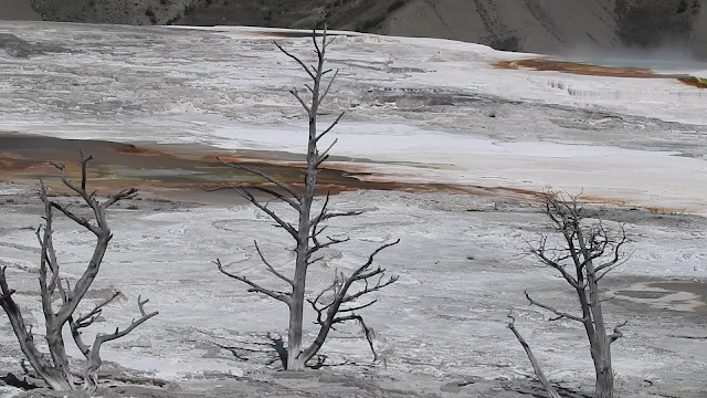
Mammoth Hot Springs is a large complex of hot springs on a hill of travertine in Yellowstone National Park adjacent to Fort Yellowstone and the Mammoth Hot Springs Historic District.[3] It was created over thousands of years as hot water from the spring cooled and deposited calcium carbonate (over two tons flow into Mammoth each day in a solution). Because of the huge amount of geothermal vents, travertine flourishes.[4] Although these springs lie outside the caldera boundary, their energy has been attributed to the same magmatic system that fuels other Yellowstone geothermal areas.
The hot water that feeds Mammoth comes from Norris Geyser Basin after traveling underground via a fault line that runs through limestone and roughly parallel to the Norris-to-Mammoth road. The limestone from rock formations along the fault is the source of the calcium carbonate.[6] Shallow circulation along this corridor allows Norris' superheated water to slightly cool before surfacing at Mammoth, generally at about 170 °F (80 °C). Algae living in the warm pools have tinted the travertine shades of brown, orange, red, and green
Thermal activity here is extensive both over time and distance. The thermal flows show much variability with some variations taking place over periods ranging from decades to days.[6] Terrace Mountain at Mammoth Hot Springs is the largest known carbonate-depositing spring in the world. The most famous feature at the springs is the Minerva Terrace, a series of travertine terraces. The terraces have been deposited by the spring over many years but, due to recent minor earthquake activity, when the spring vent has shifted, rendering the terraces dry.
The Mammoth Terraces extend all the way from the hillside, across the Parade Ground, and down to Boiling River. The Mammoth Hotel, as well as all of Fort Yellowstone, is built upon an old terrace formation known as Hotel Terrace. There was some concern when construction began in 1891 on the fort site that the hollow ground would not support the weight of the buildings. Several large sink holes (fenced off) can be seen out on the Parade Ground. This area has been thermally active for several thousand years.
The Mammoth area exhibits much evidence of glacial activity from the Pinedale Glaciation. The summit of Terrace Mountain is covered with glacial till, thereby dating the travertine formation there to earlier than the end of the Pinedale Glaciation. Several thermal kames, including Capitol Hill and Dude Hill, are major features of the Mammoth Village area. Ice-marginal stream beds are in evidence in the small, narrow valleys where Floating Island Lake and Phantom Lake are found. In Gardner Canyon one can see the old, sorted gravel bed of the Gardner River covered by unsorted glacial till.
Map
Wraith Falls
 |
| Petrified Tree |
Lamar Valley
 |
| Cook City |
 |
| Cook City |
 |
| Soda Butte Yellowstone Canyon Lower Falls of the Yellowstone Upper Falls of the Yellowstone |
Sulphur Caldron
Dragons Mouth Spring
Dragons Mouth Spring
Mud Vulcano
Previous | Main | Next |


