Previous | Main | Next |
Photos on Gmaps
Live camVideos
Route: Santiago, Valparaiso, San Antonio, Puerto Montt, Castro, Puerto Chacabuco, Chilean fjords, Punta Arenas, Ushuaia, Puerto Williams, Drake Passage, Antarctica I, Antarctica II, Antarctica III, Antarctica IV, Antarctica V, Drake Passage, Falkland Islands, Argentine Sea (South Atlantic Ocean), Puerto Madryn, Montevideo, Buenos Aires - ship Ms. Zaandam.
Places: Cape Horn, Drake Passage, Pacific Ocean, Atlantic Ocean, Southern Ocean, South Shetland Islands, Faro de Cabo de Hornos, Cape Horn Monument, Anvers Island, King George Island, Elephant Island.
Wildlife & flora: Light-mantled albatross, Cape petrel, Kelp gull.
⏳ Dec 2018
I - First Drake Passage Crossing
The Drake Passage or Mar de Hoces—Sea of Hoces—is the body of water between South America's Cape Horn and the South Shetland Islands of Antarctica. It connects the southwestern part of the Atlantic Ocean with the southeastern part of the Pacific Ocean and extends into the Southern Ocean.
It is the most perilous body of water on the planet. When Cape Horn island was discovered by a Dutch vessel in 1616 it was believed to be the southernmost point of Tierra del Fuego. The Drake passage was used from that point on extensively as a major shipping route. However the exploration was so difficult that Antarctica, only 400 miles away, was discovered after more than 200 years, in 1820. Cape Horn was named by sailors Cape Fear.
An estimated 10,000 people have died trying to sail around the Cape and 800 ships have been lost.
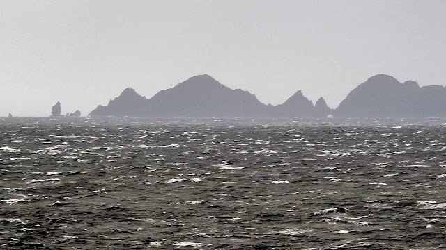
Our first Drake Passage crossing started in good weather conditions, but having a storm coming from north west behind us. The last pieces of land we saw were Isla Deceit and Isla Hornos within the Cabo de Hornos National Park. There is a chilean navy station on island and a monument in honour of the sailors who died while attempting to "round the Horn", Cape Horn Monument - Monumento Cabo De Hornos.
Cape Horn - "the Everest of Sailing"
Cape Horn
Cape Horn Monument built-in 1992 in honor of sailors who drowned at Cape Horn. It can withstand 200 km/h (125 mi/h) winds. It was damaged in a 2014 storm and then repaired.
...crossing Drake Passage
Kelp gull
We navigated west Smith Island (South Shetland Islands) and we arrived on north-est of Anvers Island.
II - Second Drake Passage Crossing
We crossed again Drake Passage, but this time we had huge waves, strong winds, storms; Started between King George Island and Elephant Island.
Southern giant petrel
We crossed two times the 60th parallel south, which marks the northern limit of the Southern Ocean. The latitudes south of this parallel are often referred to as the Screaming 60s due to the prevailing high-speed, westerly winds which can generate large waves in excess of 15 m (50 ft) and peak wind speeds over 145 km/h (90 mph).
References:
Drake Passage
60th parallel south
Previous | Main | Next |


No comments:
Post a Comment