Photos on Gmaps (scroll photos list to load them on map)
VideosRoute: Santiago, Mendoza.
Places: Santiago, Paso Internacional Los Libertadores, Transandine Railway, Control Integrado Horcones, Puente del Inca, Sendero de la laguna, Aconcagua, Rio De Los Horcones, Laguna de Horcones, Sendero Mirador Aconcagua, Aduana Chilena, Portillo, Route 60.
Wildlife & flora: Honey bee, Gray-hooded Sierra-Finch, Thick-billed Siskin, Culpeo.
Previous | Main | Next |
Paso Internacional Los Libertadores
The most important and spectacular border crossing between Chile and Argentina is from Santiago to Mendoza, at 3,207 m (10,521 ft). It is considered one of the most scenic drives in the world and makes also the list of the most dangerous roads in the world.
Los Caracoles (snails) is a part of the pass on the Chilean side (ruta 60) with 26 total hairpin turns on an extremely steep incline. Seen from the air it looks like the coils of a refrigerator - see more in English or in Spanish.
 |
| Find the bus on the road
At the middle of the Christ the Redeemer Tunnel is the national border
|
Transandine Railway
Old narrow gauge (1 meter) railway (closed in 1984) from Mendoza to Los Andes going through Puente del Inca and Portillo. It followed the ancient route of mule-trains crossing the Andes between Chile and Argentina.All international railway use was suspended in 1977-78 during the Beagle conflict that brought the two countries on the brink of war.
Today only a Chilean section is still in use, between Los Andes and Río Blanco, for transport of copper mining materials (acids, copper, copper concentrates). At Río Blanco there is a rail connection to the Codelco mine at Saladillo. Modern diesel-electric locomotives are used.
 |
Control Integrado Horcones
|
Puente del Inca
The impression of a traveler 100 years ago
The impression of a traveler 100 years ago
The name of the place comes from a legend that tells that many years before the Spanish colonization, an important noble Inca had a son who had been affected by paralysis. After trying all types of healing techniques without getting any favorable result, he heard that in the Southern lands, there was a place where healing waters could end his suffering. So, he prepared a group with his best warriors and headed towards this place. Once he arrived, he admired in amazement the famous hot springs flowing from the soil; but in the middle, there was a heavy-flowing river that blocked the access. His warriors, without hesitating, hugged each other forming a human bridge, so they could reach the other side of the river. Thus, the Inca walked through the warriors’ backs holding his son in his arms and reached the hot springs, where he found the cure he was looking for. When he looked backwards in order to thank his warriors, they were already petrified and formed what we know today as "Puente del Inca”(elportaldemendoza)
On the far right side of the picture, they are ruins of Puente del Inca hotel, built 1925 and destroyed in 1965 by a devastating avalanche, only the chapel on the far front of the picture remained intact. On the front in the center of the picture, they are thermal baths fed by hot mineral springs (38 C) with therapeutic properties. The natural bridge is over the Las Cuevas river.
Here is a picture showing the old hotel in the background,
Here is a picture showing the old hotel in the background,
The impression of a traveler 100 years ago
The impression of a traveler 100 years ago
Aconcagua
The world's longest above-water mountain range is the Andes, about 7,000 km (4,300 mi) long.
Gray-hooded Sierra-Finch and a Honey bee
Rio De Los Horcones and Aconcagua
Thick-billed Siskin
Thick-billed Siskin
Thick-billed Siskin
Fin sendero de la laguna
Fin sendero de la laguna
Gray-hooded Sierra-Finch
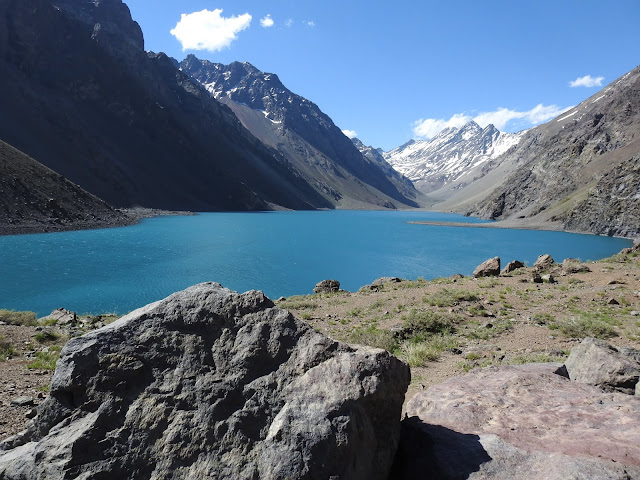
Laguna de Horcones
Laguna de Horcones
Laguna de Horcones
Laguna de Horcones
Sendero Mirador Aconcagua
Aduana Chilena (Customs)
Portillo
Portillo is located in Andes mountains of Chile, in the Valparaíso Region, 100 miles from Santiago, at an elevation of 2,880 m. There is a ski resort opened in 1949. The summit of the mountain (Ojos de Agua) climbs to 4,222 m.Previous | Main | Next |


No comments:
Post a Comment