🌐 Map
🏞 Details
📹 Videos| Previous | Main | Next | Go to |
Route: Red Rock Canyon, Death Valley, Alabama Hills - Mt Whitney, Joshua Tree, Santa Cruz Island-Pacific Coast Highway, San Diego.
Places: Mesquite Flat Sand Dunes, Daylight Pass Rd, Titus Canyon Road, White Pass, Titanothere Canyon, Red Pass, Titus Canyon, Klare Spring, Petroglyhs, Titus Canyon Narrows, Scotty's Castle Road, Ubehebe, Aprons of rock.
Wildlife & flora: Creosote bush, Cellar beetle, Cottontop barrel cactus, Beavertail cactus.
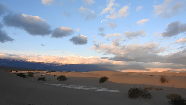
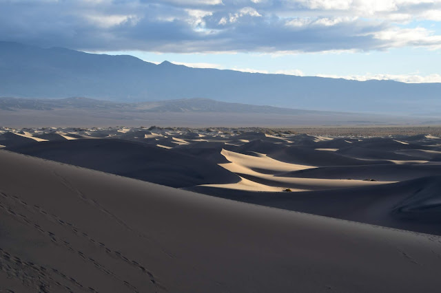
Mesquite Flat Sand Dunes
The Mesquite Flat Sand Dunes are at the northern end of the valley floor and are nearly surrounded by mountains on all sides. Due to their easy access from the road and the overall proximity of Death Valley to Hollywood, these dunes have been used to film sand dune scenes for several movies including films in the Star Wars series. The largest dune is called Star Dune and is relatively stable and stationary because it is at a point where the various winds that shape the dunes converge. The depth of the sand at its crest is 130–140 feet (40–43 m) but this is small compared to other dunes in the area that have sand depths of up to 600–700 feet (180–210 m) deep.
The primary source of the dune sands is probably the Cottonwood Mountains which lie to the north and northwest. The tiny grains of quartz and feldspar that form the sinuous sculptures that make up this dune field began as much larger pieces of solid rock.
Map
Creosote bush

Going towards Titus Canyon
on Daylight Pass Rd, crossing the border California-Nevada
Look at the little white "body", black "head" "penguin" stones
Entering Titus Canyon Road
From Highway 374 the one-way road heads west across the Amargosa Valley and climbs into the Grapevine Mountains.
Elephants Stone
White Pass and Titanothere Canyon
Right before the road climbs to Red Pass is the White Pass which enters the upper Titanothere Canyon. Colorful rock deposits along this section contain fossil beds from Eocene to Oligocene times, 30-35 million years ago, when there was an open savannah filled with prehistoric horses, giant rodents and beavers and massive mammals named titanotheres, one of them, an 8-foot rhino-like thitanothere whose fossil skull was discovered here in 1933, thus the name of the canyon.
Life reconstruction of Protitanops curryi
Red Pass
5,250' divide between Titanothere and Titus Canyons
A symphony of colors in all directions, the literally RED road is a beauty to drive, right on the edge.
The sun plays the music of its rays on the colors of the mountains.
This is indeed one of the most beautiful places on earth.
The sun plays the music of its rays on the colors of the mountains.
This is indeed one of the most beautiful places on earth.
Death Valley is the valley where you would like to die and live for eternity.
The Mojave Desert is rich with cacti and succulent species, yet in Death Valley National Park they are scarce due to the extremes of heat, dryness and soil salinity. Even so, cactus grow from an elevation of 400 feet above sea level to the summits of the surrounding mountains.
The cactus species most commonly seen are cottontop barrel, silver cholla, and beavertail cactus.
The biggest sources of water in the area, Klare Spring produces 22 gallons of water/minute.
Titus Canyon
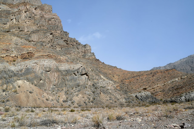
From Wikipedia: Although the Grapevine Mountains (named for the wild grapes in the area) were uplifted relatively recently, most of the rocks that make up the range are over half a billion years old. The gray rocks lining the walls of the western end of Titus Canyon are Cambrian age (570–505 million years old) limestone. These ancient Paleozoic rocks formed at a time when the Death Valley area was submerged beneath tropical seas. By the end of the Precambrian, the continental edge of North America had been planed off by erosion to a gently rounded surface of low relief. The rise and fall of the Cambrian seas periodically shifted the shoreline eastward, flooding the continent, then regressed westward, exposing the limestone layers to erosion.
The sediments have since been upturned, upfolded (forming anticlines), downfolded (forming synclines) and folded back onto themselves (forming recumbent folds).
Although some of the limestone exposed in the walls of Titus Canyon originated from thick mats of algae (stromatolites) that thrived in the warm, shallow Death Valley seas, most of the gray limestone shows little structure. Thousands of feet (hundreds of meters) of this limey goo were deposited in the Death Valley region. Similar limestone layers may be seen at Lake Mead National Recreation Area and at the bottom of the Grand Canyon. At one of the bends in the canyon, megabreccia can be seen.
The Mojave Desert is rich with cacti and succulent species, yet in Death Valley National Park they are scarce due to the extremes of heat, dryness and soil salinity. Even so, cactus grow from an elevation of 400 feet above sea level to the summits of the surrounding mountains.
The cactus species most commonly seen are cottontop barrel, silver cholla, and beavertail cactus.
Cottontop Barrel Cactus (Echinocactus polycephalus)
Klare Spring and Petroglyhs at mile 18
The biggest sources of water in the area, Klare Spring produces 22 gallons of water/minute.
From "Geology of Death Valley National Park: Landforms, Crustal Extension, Geologic History, Road Guides"
Timbisha Native Americans carved petroglyphs on some of the rock faces in Titus Canyon, especially near natural springs.
Open image in new tab to see the petroglyphs closely
The limestone bolder is cemented in place by travertine, a typical deposit of spring water
The limestone bolder is cemented in place by travertine, a typical deposit of spring water
Shadows on the mountains: Pterodactyl, Human with Spirit on his shoulder, Kite Creature, Jabba the Hutt and Elephant
From "Geology of Death Valley National Park: Landforms, Crustal Extension, Geologic History, Road Guides"
You can imagine animal imprints in this Megabreccia
Titus Canyon Narrows
From "Geology of Death Valley National Park: Landforms, Crustal Extension, Geologic History, Road Guides"
You can imagine animal imprints in this Megabreccia
Scotty's Castle Road
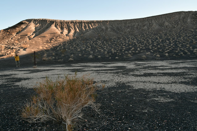
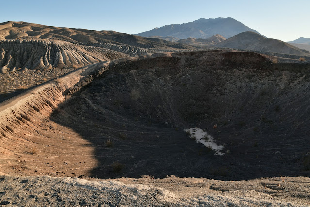
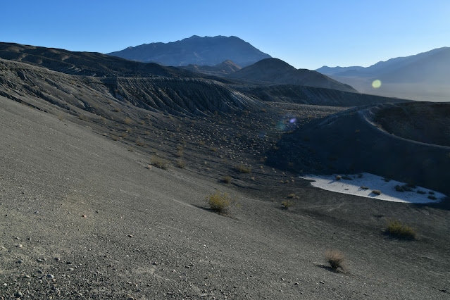
Ubehebe
Name: Paiute for "Big Basket". For Timbisha Shoshone Indians it was knows as "Tem-pin-tta- Wo’sah", meaning Coyote’s Basket.
Volcanic crater 600 ft deep and half a mile across.
Caused by violent steam and gas explosions (maar volcanoes), Ubehebe and Little Hebe craters may have formed as recently as 300 to 1300 years ago when hot, molten material came in contact with groundwater. These large depressions show that Death Valley's geology is dynamic and ever changing.
Beavertail cactus
Aprons of rock
🌐 Map
Sand storm at Mesquite Flat Sand Dunes
⏳ Dec 16, 2016
| Previous | Main | Next | Go to |


